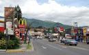
Escazú


Escazú, San José, Costa Rica
Suggest Place to Visit
977
Track to location with GPS |
 |
BRIEF HISTORICAL REVIEW
In pre-Columbian times, the territory that currently corresponds to the canton of Escazú, was a place where indigenous travelers who went to Pacaca (today Ciudad Colón) used to rest to continue to Aserrí, Curridabat or the Talamanca mountain range, either for commercial or warlike, the natives forcedly stopped there. Some of those semi-nomadic groups settled in the place, exploiting the richness of the soils for their crops. This is how this indigenous population was consolidated, from the so-called Huetar Kingdom of the West, which at the beginning of the conquest were the dominions of the cacique Garavito.
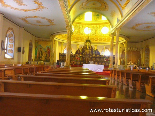
As of 1711 in Escazú an oratory already existed, which was established at the initiative of Monsignor fray Benito Garret y Arloví, bishop of Nicaragua and Costa Rica, as a result of the pastoral letter that he dictated on May 9 of the same year, as a result of on a pastoral visit to the province of Costa Rica. In 1793, the Escazú parish was erected. The current church was built on the land donated for this purpose by Don Julián Alfaro; dedicated to San Miguel, who at this moment is suffragan of the Archdiocese of San José, of the ecclesiastical province of Costa Rica.
In the administration of our first head of state, Don Juan Mora Fernández, on November 11, 1824, in Law No. 20, the title of Villa was granted to the population of Escazú. On May 27, 1920, during the government of Don Francisco Aguilar Barquero, Law No. 10 was enacted, which gave the town the category of city.
In Law No. 63 of November 4, 1825, Escazú is mentioned as a district of the Western Department, one of the two in which the territory of the State was divided at that time. In the Registry of Boundaries of the neighborhoods and barracks of the Department of San José, dated November 30, 1841, Escazú appears as a neighborhood, with the following five neighborhoods San Miguel, Mercedes, San José, San Joaquín and San Antonio. In law No. 36 of December 7, 1848, Escazú together with Pacaca form the second canton of the province of San José.
In 1848, the first session of the Escazú Council was held, made up of the proprietary councilors, Messrs. Florencio Marín, first councilor; Jacinto Elizondo, second councilor; and Antonio Solís, trustee. The municipal secretary was Don Anselmo de Rojas and the political leader Don Vicente Rojas.
In the year 1864 a school of first letters was established with the name of Escuela de Escazú. In 1938 a new school building was inaugurated, under the administration of Don León Cortés Castro, with the name of the República de Venezuela school. The Liceo de Escazú began its teaching activities in March 1970, in the government of José Joaquín Trejos Fernández.
The name of the canton comes from the indigenous voice Itzkatzú, which means resting place, which evolved to give rise to the word Escazú.
GEOGRAPHICAL POSITION
The mean geographic coordinates of the canton of Escazú are given by 09º 55 ’07´´ north latitude and 84º 09´ 19´´ west longitude.
The maximum width is thirteen kilometers; in a northwest to southeast direction, from Puente de Mulas to the Cedral hill.
TERRITORIAL ADMINISTRATIVE DIVISION
Creation and Origin
The Political Constitution of November 30, 1848, in Article 8, established for the first time the denominations of province, canton and parochial district.
In accordance with the previous provision, in Law No. 36 of December 7 of the same year, in Article 5, Escazú was created as canton number two in the province of San José, with four parish districts.
Thus Escazú comes from the aforementioned province.
PHYSICAL ASPECTS
geology
The canton of Escazú is geologically constituted by materials from the Tertiary and Quaternary periods; it is the intrusive rocks of the Tertiary that predominate in the region.
From the Tertiary period there are rocks of sedimentary and intrusive origin, from the Miocene epoch. The sedimentary ones are represented by the Pacacua formation and by undifferentiated materials, the Pacacua formation, corresponds to a sequence of materials, constituted by interstratifications of breccia conglomerates and conglomerate sandstones, sandstones, siltstones and shales, all tubaceous, in some parts with moraceous colorations, which is located to the west of the canton, close to the border with Santa Ana, and the undifferentiated materials are located to the east of the region near the border with the cantons of San José and Alajuelita.
The intrusive rocks belong to the acid intrusives of the Cordillera de Talamanca, such as quartz diorites and granodiorites, as well as gabbros and granites, which are located in the south of the canton as well as in part of the sector to the northwest of it.
Among the materials of the Quaternary period, rocks of volcanic and sedimentary origin are located; from the Holocene epoch. The former belong to volcanic materials, such as lavas, tuffs and pyroclasts, located to the north of the canton, close to the limit of the region. The sedimentary rocks correspond to fluvial and colluvial deposits, located in the sector surrounding the city of Escazú and the area to the south of it.
Geomorphology
The canton of Escazú presents three geomorphic units such as the form of volcanic origin, originated by the intrusive action and denudation in tubaceous and fluvial volcanic rocks.
The unit of volcanic origin, constituted by the volcanic fill of the Central Valley. It is located to the north and southeast of Escazú city. This unit corresponds to a flat wavy surface. It is possible that the changes in the relief within the area are due to the presence of lava a few meters deep, constituting a front. The unit is formed on the surface by volcanic rocks, mainly lavas, tuffs and ignimbrites covered by ash in a variable thickness. The sequence of lavas rests on sedimentary rock. The lavas are of the andesitic type. Geomorphologically, this unit is not a valley, however for political, socio-economic and all kinds of reference, it is considered preferable to continue calling it the Central Valley. The correct technical name is rift valley, due to the presence of a fault along the entire foot of the Central volcanic mountain range, which is evidenced by the existence of thermomineral sources, as well as the abrupt interruption aligned with the supposed fault of the foothills that descend from the aforementioned sierra to the valley, as well as the presence of volcanism without apparent explanation (Pacacua Formation), in correspondence with the position of the fault or near it.
The unit caused by the intrusive action is divided into two subunits; called the Escazú massif and the Alto de las Palomas hill. The massif subunit of Escazú is located to the south of the canton; It is characterized by presenting steep slopes, the divisions are rounded but very steep, this subunit is composed of intrusive and volcanic igneous rocks with scales or intercalations of sediments, which on the surface are very weathered, evidence of hydrothermal action is observed and pneumatolytic as a result of the neighborhood in the subsoil of intrusive masses, manifested with channeling of the rocks, silica strands and silicification in general, the subunit originated by the action caused by intrusive bodies. The Alto de las Palomas hill subunit is located in a strip that runs from the northwest sector of the canton to the area south of Villa San Antonio; This subunit constitutes an elongated hill, the slopes are gently sloping, rounded, convex, with very few superficial drainage routes. This subunit corresponds to the Pacacua formation, covered towards the lower flanks of the slopes by recent ignimbrites; Within the rocks there are very weathered tufted sandstones and somewhat affected by the hydrothermal action of local intrusions, the presence of highly clayey areas with stability problems is frequent; its formation has been originated by the action that erosion has exerted on volcano sedimentary rocks of the mentioned formation, affected by different degrees of intrusive effects
The denudation unit in tuff and fluvial volcanic rocks is represented by gently sloping hills in rocks of the Pacacua formation with very few surface drainage routes that cross it, located to the west of the canton. Flat spaces are very limited in number and size. The rock is composed of tobaceous sandstones and conglomerates, all very weathered that belong to the Pacacua formation. Small dikes are visible. It may have developed in a strictly continental environment. The ash contributions carried by the fluvial currents that gave rise to rocks with a sandy texture formed of volcanic particles. The same happened with the coarser fractions that gave rise to clusters. Small dikes subsequently cut into these rocks.
Altitudes
The elevations, in meters above mean sea level, of the urban center of the canton's districts are as follows:
Escazú City 1,101, Villa San Antonio, 1,245 and Villa San Rafael 1,042.
Hydrography
The fluvial system of the canton of Escazú corresponds to the Pacific slope, which belongs to the Grande de Tárcoles river basin.
The canton is drained by the Agres river, and its tributaries Chiquero, Cruz and Convento, as well as by the Yeguas stream, which are tributaries of the Tiribí river, and this of the Virilla river.
The previous water courses, except the last two, are born in the canton, on the slopes of the Escazú hills, which have a course from south to north and from southeast to northwest.
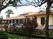
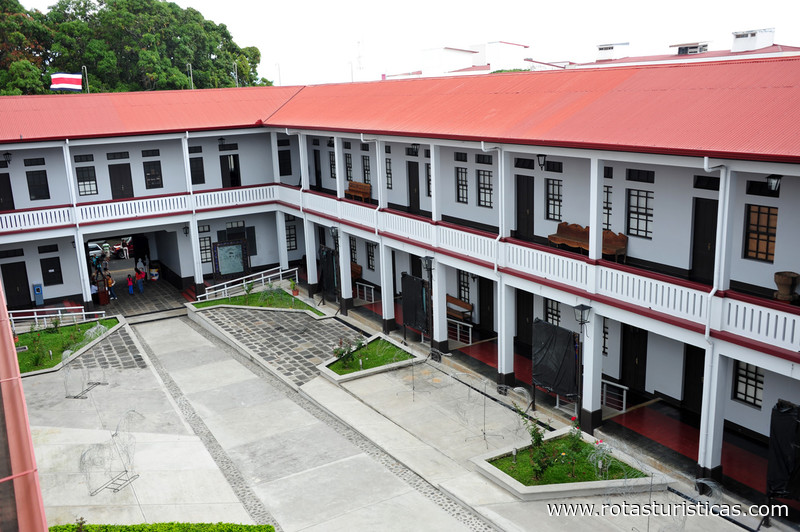
In the center of the town of Escazú, it is still common to find old houses built at the beginning of the century, which are kept in good condition and are a worthy reminder of the cultural heritage that the town has. In contrast to the old houses, the town has been filled with an important urban infrastructure and a large number of condominiums and buildings can already be seen. In the district of San Antonio, a until recently rural area, it is more common to see these houses of yesteryear.
Comments
We don´t have yet any comments about:
Escazú
Escazú
Be the first to leave a comment as it is very important to inform other people
Outros locais a visitar
Within a radius of 20 km from:Escazú
Pacuare |
| 4,5 Km |
 |
La Sabana: le parc du Costa Rica |
| 6,3 Km |
 |
San José |
| 6,3 Km |
 |
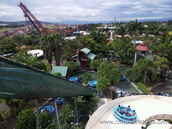
Water Land |
| 7,0 Km |
 |
Heredia |
| 8,2 Km |
 |
Club Campestre Español |
| 9,1 Km |
 |
Saint-Domingue |
| 9,2 Km |
 |
Barva |
| 11,3 Km |
 |
COLYPRO |
| 11,4 Km |
 |
Santa Barbara |
| 13,1 Km |
 |
Fossil Land |
| 13,2 Km |
 |
Catedral de Alajuela |
| 13,3 Km |
 |
Museo Histórico Cultural Juan Santamaría |
| 13,4 Km |
 |
Souvenir Museum Verdes y Colores |
| 14,7 Km |
 |
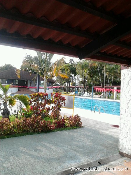
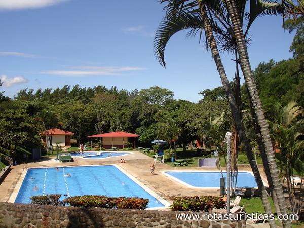
Parque Recreativo Los Manantiales |
| 19,4 Km |
|
Hotel reservation near Escazú within a radius of 20 km

Why to book with ROUTES TOURISTIQUES
The best prices
Our partnerships with the world´s largest operators offer research on the best market prices.
More options
At Rotas Turisticos you can book the hotel, buy the air ticket, book the transfer from the airport to the hotel and vice versa, book the local excursions, rent the car, take travel insurance and consult the places to visit and where to go.
Holiday Tips & Destinations
Hundreds of holiday destinations with all the options that allow you to easily choose the destination that best suits your dream vacation.
ROUTES TOURISTIQUES
Links
Follow us on social networks


